

Precision Agriculture
Modern farming relies on smart technology like precision navigation and automated equipment to maximize efficiency, yield and sustainability. MaxNav’s GNSS and auto-steering systems provide farmers

GIS
In GIS, accurate geospatial data is crucial for a variety of applications, from urban planning to environmental monitoring. MaxNav’s GNSS solutions, including the C50 Data
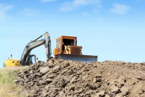
Construction
Precise geospatial data forms the foundation of land development and infrastructure projects. MaxNav supports construction teams with robust GNSS systems that streamline site layout, grading,

Land Surveying
In land surveying, precise geospatial data forms the foundation of land development and infrastructure projects. MaxNav’s GNSS solutions, including receivers and handheld devices, provide the